Loading

The South West Coast Path

Martinhoe Cleave Cottages

Martinhoe Cleave Cottages are very conveniently located for accessing the Minehead to Combe Martin Section of the South West Coast Path.

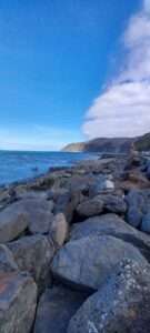
At 35 miles long, the section of the South West Coast Path here makes up just over 5% of the entire National Trail. It runs from the Path’s start point at Minehead to Combe Martin in North Devon and has long been praised as one of the main reasons Exmoor was dedicated a National Park in 1954.

When it comes to talking about the Exmoor coast, it really is a story of superlatives. In England and Wales, it holds titles for; the highest coastline, soaring to a heady 433m (1,421 ft) at Culbone Hill, the highest sea cliff with Great Hangman peaking at 244m (800ft) and the longest stretch of coastal woodland between The Foreland and Porlock. Finally, and admittedly this final stat is not unrivalled, the Exmoor coast is home to one of the highest tidal ranges in the world, second only to Fundy Bay in Eastern Canada. Here, the rise and fall of the tides can be as much as 15m (48ft).

To the West of Combe Martin is the North Devon Section of the path.  Most of this section faces out over the Bristol Channel, offering lofty coastal vistas from places like Combe Martin, Ilfracombe, Lee Bay and Morthoe. The golden sands of Woolacombe, Croyde and Saunton Sands lie beyond, offering some of the region’s best surfing. From there discover Braunton Burrows, one of the largest sand dune systems in the British Isles, located in the heart of the North Devon Area of Outstanding Natural Beauty (AONB) and part of the North Devon UNESCO designated Biosphere reserve.

In the centre of the North Devon stretch is the large joint estuary of the Taw and Torridge Rivers, flanked by areas of sand dunes and marshland. The SWCP follows old railway lines around the estuary, crossing the rivers at the towns of Barnstaple and Bideford. The stretch beyond this demonstrates the SWCP’s unique role in linking up coastal communities in places like Appledore, Instow, Bideford, Westward Ho! and the quirky fishing village of Clovelly. The section culminates with one of the great defining headlands on the SWCP, Hartland Point. Here the Path changes from heading east to west, to north to south. It’s character changes with brooding cliffs behind jagged fingers of rock stretching into the Atlantic Ocean.

Other Walking Routes

As well as the South West Coast Path, the area is home to other long-distance walking routes: the Two Moors Way which runs between Lynmouth on the north Devon coast and Ivybridge in South Devon, crossing Exmoor and Dartmoor; the Tarka Trail which includes walking and cycle routes around Exmoor and the North Devon coast associated with the Tarka the Otter novel; and the Coleridge Way which links sites across Exmoor and the Quantock Hills associated with the poet.

An afternoon in Lynmouth

Last week, we took a trip down to Lynmouth for the afternoon. It was the antidote we needed to a very busy week. Although the sun was shining, there was still a chill in the air, so we wrapped up warm. We sat on the Esplanade for well over an hour watching people come and go. Some just enjoying the sights and sounds of the village, others who had been on one of the many local walks and were ending the day in Lynmouth and some enjoying delicious local fish and chips – the gulls hovering overhead, waiting for any leftovers. We noticed how vibrant the colours were, a real feast for the eyes. The fresh new green of the trees coming into leaf, the bluest of skies which was reflected onto the sea, the sun picking up the colours of the hills at Countisbury and Foreland. We came away feeling happy, relaxed and motivated. Just what the Dr ordered.

Visit Lynton & Lynmouth website

Lynmouth Harbour

Lynmouth Harbour

Lynmouth to Foreland

Lynmouth to Foreland

Exmoor National Park

Exmoor Ponies

Exmoor Ponies

Exmoor is a unique place shaped by people and nature over thousands of years and is recognized as one of the UK’s finest landscapes.  Large areas of open moorland provide a sense of remoteness and tranquillity rare in southern Britain. Spectacular coastal views, deep wooded valleys, high sea cliffs and fast flowing streams all combine to form a rich and distinct mosaic. Click here to link to a short video of the National Park.

The South-West Coastal Path runs through the area  and there are many other walks in and around the area.

Exmoor ponies roam freely on the moor. You can see them at close quarters at The Exmoor Pony Centre at Dulverton. Started in 1998, its aim is to work to conserve and promote the welfare of this rare breed pony.

Below are some videos provided by the South West Coast Path Association showcasing some of the wonders of Exmoor:

English

Nederlands

Deutsch


Lynton & Lynmouth

Lynton

Lynton

Known by the Victorians as Little Switzerland, the twin towns of Lynton and Lynmouth offer a unique visitor experience including a craft centre and cinema, many shops, galleries, cafes and restaurants.   They are linked by a cliff railway. Established in 1888, this water-powered lift takes passengers up and down the cliff between the towns. It uses no power other than water from the River Lyn to run it.

The Valley of Rocks

Valley of Rocks

Valley of Rocks

The Valley of Rocks is a dry valley that runs parallel to the coast about half a mile west of Lynton. It is noted for its herd of goats, its geology and its stunning views.

Watersmeet


Waterfall at Watersmeet

Waterfall at Watersmeet

Standing at Watersmeet some 2,300 years ago you would have seen smoke rising from the hilltops, a sign of people living close by. Two fortified farmsteads known as Myrtleberry North and South camp provided a protected home.

Thatched round houses were lived in by Iron Age people and their animals. The village would have been surrounded by ramparts and steep-sided hills. Whilst not much evidence remains, the views are stunning from these now-scheduled monuments and well worth the climb.

Watersmeet is surrounded by 2000 acres of estate and is a dramatic river gorge clothed with ancient woodlands. At the meeting place of the East Lyn River and Hoar Oak Water stands Watersmeet House. Built in 1832 as a fishing and hunting lodge for Walter Stevenson Halliday, it is now a haven for many visitors. Originally a fishing lodge and romantic retreat, with connections to the romantic poets, since 1901 it has been a tea room. There are many paths leading along the riversides and up the valley sides to Lynmouth, Rockford and Countisbury.

Look out for otters, red deer, buzzards, dippers, herons and a variety of flowers and insects. You may spot the local whortleberry, a small bluish-black berry often used to make jam. Like a wild bilberry, it grows on shrubs from July to August.

A short walk upstream from Watersmeet House is Ash Bridge, a tranquil spot surrounded by crystal-clear waters and shady ancient woodland. Look out for dippers bobbing on the rocks, and if you’re lucky, the salmon that come here to breed.

For the more adventurous, canoeing is possible on the East Lyn River from Watersmeet House down to Lynmouth between 1 October and 31 March if there’s enough water.

Social media & sharing icons powered by UltimatelySocial
Verified by MonsterInsights